

Walker's Paradise
95
Walk Score ®
Out of 100
Lace up your walking shoes because this area is considered a walker’s paradise.
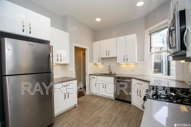
500 Eugenia Ave, San Francisco, CA 94110
500 Eugenia Ave, San Francisco, CA 94110
Url: http://offcampushousing.usfca.edu/housing/property/500-eugenia-ave/sv6lwp7
Phone Number: (628) 333-2089
Data provided by TravelTime
| Number of Bedrooms | Number of Bathrooms | Rent Range | Square Footage | Name of Floor Plan | Unit Number | Availability | Newly Added | View More Details |
|---|
The fees below are based on community-supplied data and may exclude additional fees and utilities.
| Mission At Cesar Chavez | Walk: 13 min | Distance: 0.7 mi |
|---|---|---|
| Diamond Heights Shopping Center | Walk: 28 min | Distance: 1.5 mi |
| Bayview Plaza | Walk: 41 min | Distance: 2.1 mi |
| United States Navy Reservation | Drive: 14 min | Distance: 5.0 mi |
|---|---|---|
| East Fort Miley | Drive: 21 min | Distance: 7.4 mi |
| San Jose Ave & Randall St | Walk: 9 min | Distance: 0.5 mi |
|---|---|---|
| San Jose Ave & Randall St | Walk: 9 min | Distance: 0.5 mi |
| 30Th Street And Dolores | Walk: 7 min | Distance: 0.4 mi |
| J Line Outbound | Walk: 10 min | Distance: 0.5 mi |
| Church And 29Th Street | Walk: 11 min | Distance: 0.6 mi |
| Bayshore Caltrain Station | Walk: 56 min | Distance: 2.9 mi |
| 22Nd Street Caltrain Station Southbound | Walk: 46 min | Distance: 2.4 mi |
| 22Nd Street | Walk: 46 min | Distance: 2.4 mi |
| San Francisco 4Th & King | Drive: 8 min | Distance: 4.1 mi |
| San Francisco Caltrain Station Southbound | Drive: 8 min | Distance: 4.2 mi |
| San Francisco International | Drive: 18 min | Distance: 10.9 mi |
|---|---|---|
| Metro Oakland International | Drive: 35 min | Distance: 22.5 mi |
| City College of San Francisco | Walk: 46 min | Distance: 2.4 mi |
|---|---|---|
| California College of the Arts | Walk: 53 min | Distance: 2.8 mi |
| UC San Francisco, Mission Bay | Walk: 58 min | Distance: 3.0 mi |
| UC San Francisco, Parnassus | Drive: 12 min | Distance: 4.6 mi |
| Buena Vista Park | Walk: 57 min | Distance: 3.0 mi |
|---|---|---|
| Randall Museum | Walk: 50 min | Distance: 2.6 mi |
| Heron's Head Park | Walk: 56 min | Distance: 2.9 mi |
| Candlestick Point State Recreation Area | Walk: 63 min | Distance: 3.3 mi |
| Children's Creativity Museum | Drive: 9 min | Distance: 4.4 mi |
There are no reviews for this property. Be the first to add a review on this property.